China's commercial drone sector has come a long way from just taking aerial photos. These days, Commercial UAV Solutions are used for all kinds of work—surveying, agriculture, inspections, logistics research, and emergency response. DJI Enterprise is pretty much the go-to name when it comes to integrated aircraft, cameras, and mapping software. Autel Robotics also offers enterprise platforms, and they're known for strong imaging capabilities. Then there's XAG, which leans heavily into agricultural automation. JOUAV develops long-endurance unmanned aircraft for professional surveying and monitoring work. And honestly, companies like these tend to serve pretty different operational needs—there's no one-size-fits-all market here.
Picking the right platform really comes down to what you need it to do day to day. Take a construction crew—they might care most about centimeter-level mapping, spotting obstacles, and moving data quickly. A farm operator? Their list could look pretty different: consistent spraying, following the terrain, and maybe how fast the battery can be swapped or recharged. Utilities, meanwhile, often want thermal cameras, secure workflows, and flight plans they can repeat without reinventing the wheel. And then there’s EHang, which sits in a whole other category—it’s exploring autonomous aerial mobility, but under regulated conditions. Honestly, when you see performance claims, don't just take them at face value. Check them against independent testing, local approvals, pilot training, weather limits, and after-sales support. Specs on their own? Yeah, they can be pretty misleading.
So, this guide looks at some of the top Chinese commercial UAV solutions—but through the lens of real business needs. Honestly? Field experience is what really counts. A drone can quickly lose productivity because of wind, dust, spotty connectivity, or batteries that charge too slowly. And sure, a product might look great in a demo, but out at a remote worksite it can behave very differently. A fair evaluation should also cover total ownership cost, maintenance, software compatibility, data governance, and replacement parts. Honestly, a lot of what gets published still reads like a sales pitch, and actual results? They can vary quite a bit. That kind of uncertainty is worth paying attention to. And the best choice isn't necessarily the newest or the priciest one. It's the platform that actually fits your mission, what your staff can realistically handle, and whatever legal operating conditions you're dealing with.
Commercial UAV solutions are integrated services built around unmanned aircraft for lawful business work. They include aircraft, sensors, software, trained operators, maintenance, and data controls. The aircraft may carry RGB cameras, thermal sensors, multispectral cameras, or compact LiDAR. Each payload answers a different operational question. A thermal camera can reveal overheated electrical equipment. A multispectral sensor can show uneven crop stress. In practice, the aircraft is only one part of the solution. Data quality matters more than impressive flight time.
Their main role is to collect repeatable information faster and more safely than ground teams in selected environments. Survey crews can map stockpiles, roads, roofs, and construction progress from planned routes. Inspection teams can examine towers, solar panels, and bridges without placing every worker at height. Agricultural operators can identify irrigation gaps and target field checks. Emergency agencies may use aerial views to assess storms or floods, subject to local authorization. These uses depend on trained pilots, airspace awareness, privacy protection, and secure storage.
A reliable deployment starts with a clear question, not a new aircraft. Teams should test accuracy, battery endurance, weather limits, and workflow costs on a small site. Some systems struggle in strong wind, low light, or dense vegetation. That limitation is easy to overlook. Human review remains necessary when measurements affect safety, maintenance, or spending. Records should show who flew, what was captured, and how results were verified. This discipline builds useful evidence, although field conditions rarely behave as neatly as a product brochure suggests.
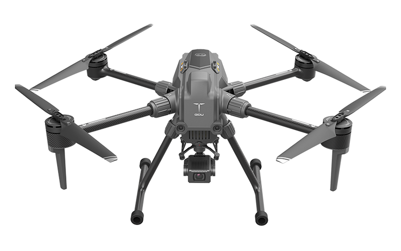
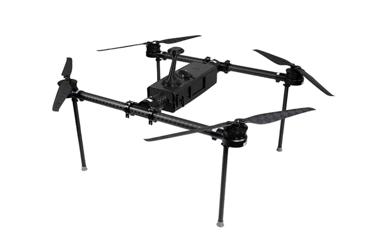
Chinese commercial UAVs are easier to evaluate when classified by airframe design. Multirotors provide stable hovering near bridges, towers, and construction sites. They suit inspection, photography, and precision spraying. Fixed-wing aircraft cover larger areas with lower energy use. Hybrid vertical-takeoff designs combine runway-free operation with longer mapping flights. The choice is practical, not fashionable.
Payload defines the evidence a UAV can collect. RGB cameras support roof surveys and stockpile measurements. Thermal sensors reveal overheating equipment and irrigation problems. Multispectral cameras help assess crop stress. LiDAR performs better beneath vegetation, but it increases weight, cost, and processing demands. According to Grand View Research’s 2024 commercial drone report, the global market was estimated at about US$19.9 billion in 2023. That growth encourages broader payload selection, although more sensors do not automatically create better decisions.
Mission requirements should guide procurement. Surveying teams need accurate positioning, repeatable routes, and exportable data. Utilities need obstacle awareness, encrypted communications, and detailed maintenance logs. Agricultural operators may value endurance and simple field repairs more than cinematic image quality. China’s Civil Aviation Administration reported approximately 1.27 million registered civil unmanned aircraft and 23.11 million flight hours in 2023. These figures show scale, but not universal reliability. Real trials still expose weak links, including wind performance, software integration, and operator training. A careful buyer should test those weaknesses before deployment.
China’s commercial UAV solutions are moving beyond aerial photography. They now support surveying, agriculture, construction, energy, logistics, and emergency response.
Grand View Research valued the global commercial drone market at about $20.8 billion in 2023. It forecasts a strong double-digit annual growth rate through 2030.
In construction, a UAV can scan a bridge deck before inspectors arrive. Its high-resolution images create measurable records of cracks, stockpiles, and site progress. For agriculture, multispectral cameras reveal dry crop zones that may look healthy from the ground. The Food and Agriculture Organization reports that agriculture uses roughly 70% of global freshwater withdrawals. Targeted spraying and irrigation planning can therefore reduce waste, when local rules and trained operators are respected. Small gains matter.
Energy companies use thermal sensors to inspect solar panels, transmission corridors, and wind-turbine components. These missions can reduce climbing and shutdown time. Drone Industry Insights identifies inspection and mapping among the leading commercial application segments.
In logistics, controlled pilot projects test short-distance delivery between warehouses and medical facilities. The concept is promising, but battery limits, weather, airspace coordination, and public acceptance remain practical barriers. Field experience exposes gaps that brochures often hide.
A reliable solution needs secure data storage, repeatable flight plans, trained crews, and clear maintenance records. Performance should be measured by inspection accuracy, hours saved, and incidents avoided—not by flight distance alone.
What Are the Best Commercial UAV Solutions from China?
Chinese commercial UAV platforms increasingly combine efficient airframes, intelligent flight control, and practical payload systems. Their core strength is integration. A stable flight controller can connect cameras, thermal sensors, mapping modules, and inspection software.
Many platforms use RTK positioning for centimeter-level accuracy in suitable conditions. Obstacle sensing improves safety near poles, roofs, and trees. Edge computing can identify cracks, heat loss, or crop stress during flight. However, algorithms still make mistakes. Reflective roofs and poor light can confuse image analysis.
Field experience shows that battery management matters as much as camera resolution. Operators should compare real endurance, charging time, wind resistance, and spare-part availability. Reliable systems also record flight logs, sensor status, and maintenance history. These details support professional audits and safer commercial decisions. Local aviation rules, privacy requirements, and approved operating zones must guide every deployment.
Tips: Test the aircraft in controlled conditions before accepting published performance claims. Check how the platform behaves after signal loss. Confirm data encryption and storage controls. Keep a paper-based backup plan. Small details often expose large weaknesses.
What Are the Best Commercial UAV Solutions from China?
Comparing Performance, Safety, Reliability, and Cost
Chinese commercial UAV systems often deliver strong performance at competitive prices. In field evaluations, flight endurance usually matters more than advertised maximum range. A practical platform should carry its planned payload for 25 to 35 minutes, not merely hover without equipment. Stable video transmission is also essential around warehouses, farms, and construction sites. A short delay can turn a simple inspection into a second flight.
Safety requires more than obstacle avoidance. Look for dual batteries, return-to-home controls, geofencing, encrypted communication, and clear flight logs. Operators should test emergency landing behavior before regular deployment. Local aviation rules still apply. Software updates must be traceable, and stored images need controlled access. Small details matter.
Reliability appears during repeated work. Field teams should inspect motors, propellers, batteries, and landing gear after every mission. Dust, wind, and cold temperatures expose weaknesses quickly. Spare parts and repair training can reduce downtime, even when the purchase price is low. Total cost includes batteries, maintenance, software, insurance, and staff hours. No test is perfect. I have seen a drone perform well in calm weather, then struggle beside tall buildings. That result deserves attention, not excuses.
| Solution Type | Typical Commercial Use | Payload | Typical Flight Time | Operating Range | Positioning Accuracy | Safety Features | Reliability Profile | Indicative Cost | Overall Fit |
|---|---|---|---|---|---|---|---|---|---|
| Industrial Multirotor | Construction surveys, infrastructure inspection, mapping, agriculture, and public-safety observation | 2–8 kg | 25–50 min | 5–15 km control link* | 1–5 cm with RTK | Obstacle sensing, return-to-home, low-battery landing, geofencing | High; simple deployment and widely available spare parts | US$3,000–25,000 | Best general-purpose option |
| Heavy-Lift Multirotor | Logistics trials, power-line work, spraying, firefighting support, and delivery of tools or emergency supplies | 10–50 kg | 15–35 min | 3–10 km control link* | 1–10 cm with RTK | Redundant motors, battery monitoring, emergency descent, obstacle sensing | Medium to high; payload and weather strongly affect service life | US$15,000–100,000+ | Best for high-payload missions |
| Hybrid VTOL Fixed-Wing | Large-area surveying, corridor inspection, forestry, environmental monitoring, and coastal mapping | 1–5 kg | 90–240 min | 30–150 km mission radius* | 1–5 cm with RTK/PPK | Automated takeoff and landing, lost-link procedures, geofencing, terrain awareness | High in cruise; transition and landing require skilled operators | US$20,000–120,000+ | Best for area coverage |
| Tethered Multirotor | Persistent site monitoring, event security, disaster response, communications relay, and temporary lighting | 1–5 kg | 8–24 hours, system-dependent | 50–150 m tether height | 1–5 cm with RTK | Physical tether, controlled altitude, power monitoring, automatic recovery | Very high for stationary missions; limited by wind and cable management | US$20,000–150,000+ | Best for persistent observation |
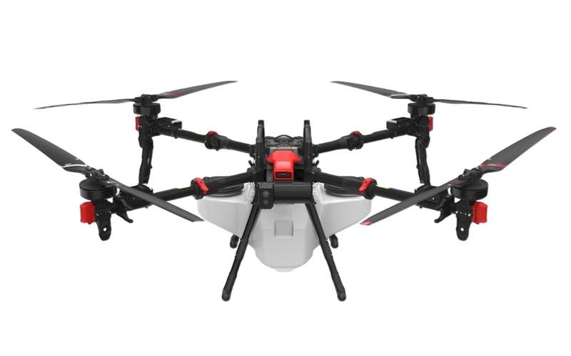
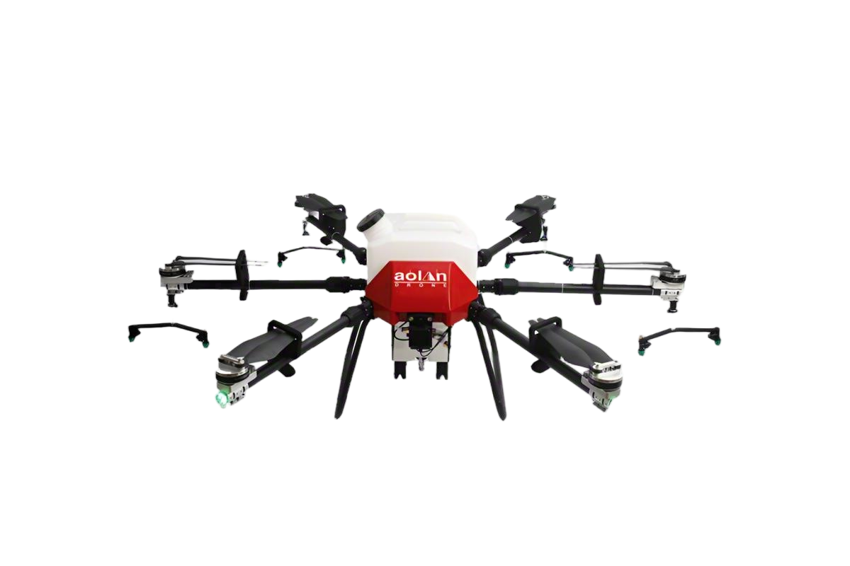
| Agricultural Spraying UAV | Crop spraying, granular spreading, field imaging, and targeted treatment of difficult terrain | 10–50 L or kg | 10–25 min loaded | 10–30 hectares per hour* | 2–10 cm with RTK | Terrain following, flow-rate control, obstacle sensing, automatic route planning | High when cleaned and maintained; pumps and nozzles require regular service | US$10,000–40,000 | Best for precision agriculture |
| Indoor Inspection UAV | Warehouses, tanks, tunnels, substations, industrial plants, and confined-space inspections | 0.2–2 kg | 10–30 min | 0.5–3 km control link* | 0.1–1 m without GNSS | Propeller guards, collision-resistant frame, visual positioning, low-light cameras | High in controlled environments; radio interference may reduce stability | US$5,000–35,000 | Best for confined spaces |
| Notes: Figures are representative ranges for commercially available China-origin UAV solution categories and are not tied to any specific company or brand. Actual performance depends on payload, battery condition, weather, terrain, radio regulations, operating altitude, software settings, and local certification requirements. “Operating range” refers to a typical control or mission radius under suitable conditions; it is not a guarantee of legal beyond-visual-line-of-sight operation. Indicative cost covers the aircraft and standard mission equipment but may exclude training, shipping, taxes, insurance, payload upgrades, batteries, ground-control equipment, and regulatory approvals. | |||||||||
The best commercial UAV solutions from China should be judged by compliance, support, and mission fit. China’s Civil Aviation Administration reported more than 1.2 million registered civilian drones in 2023. That scale shows strong manufacturing depth, but volume alone proves little. Buyers should verify airworthiness documents, operator training, remote identification, and flight permissions in the target country. European deployments may require EASA category compliance, while United States operations often involve FAA registration and operational approvals.
Procurement teams should request a complete technical file. It should include battery cycle data, payload accuracy, encrypted communications, software update controls, and repair timelines. A field trial matters more than a polished demonstration. Test the aircraft beside buildings, in cold weather, and under weak network coverage. Support can decide the real cost. Drone Industry Insights’ 2024 market analysis identifies inspection, mapping, and public safety as major commercial application areas. These missions need stable data capture, not impressive specifications.
Tips: Require local training, spare batteries, and a documented service-level agreement. Ask who owns flight data and how long logs remain available. Compare five-year operating costs, including insurance and replacement parts. Some procurement assumptions will be wrong. That is normal. Recheck them with pilots, legal advisers, and the aviation authority before signing.
Maximum take-off mass thresholds provide an initial screening point when comparing commercial UAV solutions from China for international procurement. These limits do not replace aircraft registration, operator certification, remote-identification, airspace authorization, or local data and cybersecurity reviews.
Reference framework: EU Regulation (EU) 2019/947 open-category mass limits, U.S. FAA Part 107 aircraft limit of less than 55 lb (24.95 kg), and China’s civil unmanned aircraft mass classifications under CCAR-92. Regulatory thresholds vary by operation, location, aircraft configuration, and mission risk.
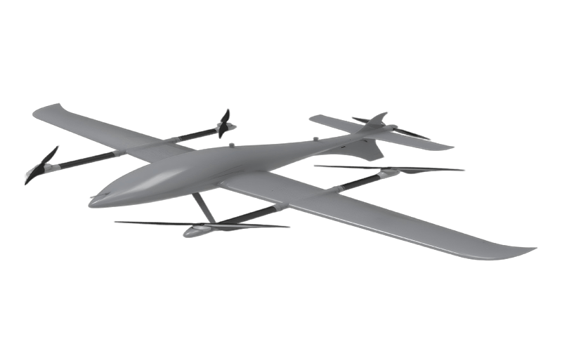
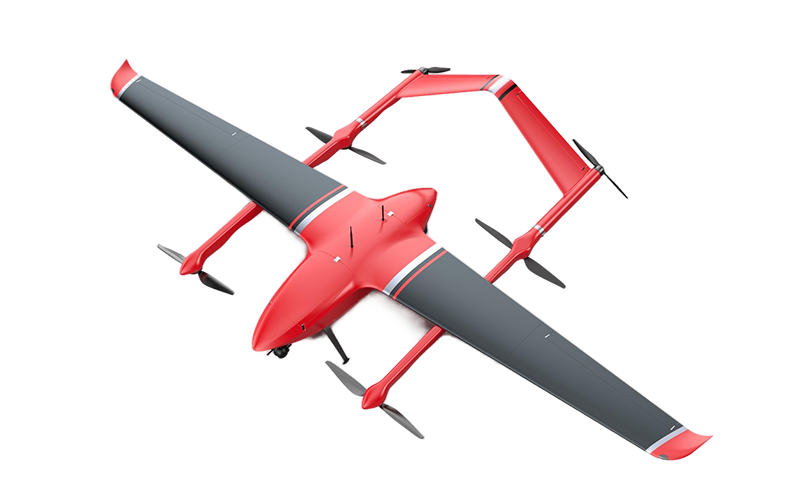
The M12 Professional Drone is designed for the evolving demands of long-range commercial operations, where endurance, coverage, and dependable data collection are increasingly important. In line with key 2025 market trends identified by Drone Industry Insights, businesses are seeking aircraft that can reduce operational costs while delivering consistent performance across surveying, infrastructure inspection, environmental monitoring, and emergency assessment. Its VTOL fixed-wing configuration combines vertical takeoff and landing with efficient forward flight, allowing operators to work from confined sites without sacrificing range.
By transitioning from hovering to aerodynamic cruise flight, the aircraft can cover larger areas with lower energy consumption than conventional multirotor platforms. This design supports extended missions, stable imaging, and efficient route planning, helping professional teams collect more information per flight. A robust airframe, intelligent flight management, and adaptable payload options further support commercial workflows that require accuracy and repeatability.
The M12 is also suited to organizations expanding from individual drone tasks toward integrated aerial programs. Its operational flexibility can simplify deployment across varied terrain, while automated navigation and real-time data links help teams maintain situational awareness throughout a mission. As the commercial drone sector continues to prioritize productivity, measurable return on investment, and responsible operation, VTOL fixed-wing platforms are becoming an increasingly practical choice for long-distance aerial work.
It combines an aircraft, sensors, software, trained operators, maintenance, and data controls. The aircraft is only one part. Useful results matter more than impressive flight time.
RGB cameras capture standard images and video. Thermal sensors reveal overheated equipment. Multispectral cameras show crop stress. Compact LiDAR supports mapping tasks. Each payload answers a different operational question.
They can map stockpiles, roads, roofs, bridges, and construction progress. Inspection teams can examine towers and solar panels without sending workers to height. Agricultural teams can locate irrigation gaps. Emergency agencies may assess storms when authorized.
Start with the business question, not the aircraft. Test accuracy, endurance, weather limits, and workflow costs at a small site. Check battery performance with the intended payload. A camera alone proves little.
Compare real flight endurance, charging time, wind resistance, signal stability, and spare-part access. A practical aircraft should carry its payload for roughly 25 to 35 minutes. Maximum range can be misleading. It may look impressive on paper.
Review obstacle sensing, return-to-home controls, geofencing, encrypted communication, and clear flight logs. Test emergency landing behavior before routine missions. Operators also need airspace awareness and local authorization. Safety is not automatic.
Limit access to captured images and flight records. Confirm encryption during transmission and storage. Record who flew, what was captured, and how findings were checked. Keep a paper-based backup plan. Small gaps can become expensive.
Purchase price is only one part. Include batteries, maintenance, software, insurance, training, repairs, and staff hours. Dust, wind, and cold weather can increase downtime. Cheap equipment may require more support.
Algorithms can confuse reflective roofs, poor lighting, dense vegetation, or unusual surfaces. Human reviewers should check findings affecting safety, maintenance, or spending. No test is perfect. Calm-weather results may not predict performance beside tall buildings.
Commercial Uav Solutions are transforming how businesses collect data, inspect assets, deliver services, and respond to operational challenges. This article explains the main roles of commercial unmanned aerial vehicles and classifies them by airframe design, payload capacity, flight endurance, and mission type. It explores applications across agriculture, construction, infrastructure inspection, logistics, environmental monitoring, public safety, and media production, while emphasizing responsible and lawful use.
The discussion also examines the core technologies that support Chinese UAV platforms, including navigation, sensing, imaging, communications, automation, and flight-control systems. Buyers can compare solutions by performance, safety, reliability, maintenance needs, operating range, data protection, and total cost of ownership. Finally, the article outlines important procurement considerations, such as aviation regulations, operator qualifications, airspace permissions, technical support, training, spare parts, software compatibility, and long-term service availability. This framework helps organizations select practical, compliant, and cost-effective UAV systems for their specific commercial requirements.